By public boat
40 islands · 7 departure points
Most people know the island boats from Rådhusbrygga. Further out in the fjord there are services almost nobody has heard of: the seasonal ferry «Undine» from Alværn to Steilene, the fortress ferry across Drøbaksundet, and scheduled boats from Skjærhalden to car-free islands a hundred kilometres from the city. 20 of them have a quay in Entur’s system, so the departures on their island page are live.
The long route south. Calls at the islands on the way and ends at Son.
The west side of the fjord to Håøya, Oscarsborg and Drøbak.
- Aker brygge
- Fornebu
- Vollen
- Slemmestad brygge
- Håøya
- Oscarsborg vestre kai
- Drøbak
The inner-harbour island boat, all year.
- Aker brygge
- Hovedøya
- Lindøya øst
- Gressholmen
- Bleikøya
- Nakkholmen
- Lindøya vest
- Hovedøya
- Aker brygge
To Gressholmen and Langøyene in summer.
- Aker brygge
- Gressholmen
- Langøyene
- Gressholmen
- Aker brygge
Rådhusbrygge 4
Central Oslo 12 islandsThe island boats in the inner harbour. An ordinary Ruter ticket is valid, and most of them run all year.
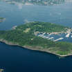 HovedøyaOslo's best-known recreation island (0.47 km²), full of history: the ruins of a Cistercian monastery founded in 1147, medieval quarries, fortifications from 1808 with their cannon and powder magazines, and German army barracks from the Second World War. Rich plant life, notable geology, and popular places to swim. 2.4
 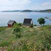 BleikøyaA small island in the inner Oslofjord between Hovedøya and Sjursøya, with around 90 holiday cabins from the 1920s and 30s. From 1885 to 1926 it held a sanatorium for children with scrofula, a form of tuberculosis. The writer Oskar Braaten was a patient here as a boy. State-owned and managed by Statsbygg, the government property agency. 2.5
 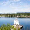 LindøyaA state-owned island (0.41 km²) in the inner fjord, known for its 289 small cabins organised into 16 sections. The settlement began with tents around 1905. There is a shop, a football pitch and swimming spots open to the public. 2.6
 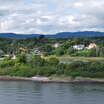 HerbernGroup of islets southeast of Bygdøy in the inner Oslofjord, made up of Store Herbern and Lille Herbern. Store Herbern is a nature reserve with shore vegetation and several rare species; Lille Herbern is known for its summer restaurant. 2.6
  Lille HerbernA small islet right next to Store Herbern, southeast of Bygdøy. Known for a long-established summer restaurant reached by a small ferry from Bygdøy. 3.0
  GressholmenA green island in the inner Oslofjord, joined by land to Rambergøya and Heggholmen. Norway's first airport opened here in 1927 and was the country's main airport until 1939. Gressholmen Kro, the island inn, is open through the summer. Several swimming spots, including a naturist area. 3.2
  HeggholmenIsland joined to Gressholmen and Rambergøya by infill. Heggholmen lighthouse on the northern tip is the oldest in the inner Oslofjord and is a protected monument. There was industry here once, a steam-driven linseed oil press and soap production, with remains of the workers' housing and the school building. A few private cabins. 3.2
  NakkholmenState-owned island about 600 m off Bygdøy, densely built with small cabins from the 1920s. There are 182 of them, and their size, colour and appearance are tightly regulated. A shipyard ran here from 1918 to 1952. Open to public access and outdoor recreation. 3.5
 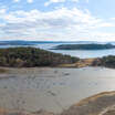 RambergøyaIsland of about 12 hectares (120 dekar), joined by land to Gressholmen and Heggholmen and part of the Gressholmen-Rambergøya nature reserve. The lime-rich pine forest (*kalkfuruskog*) here is among the most intact on the islands of the inner Oslofjord. There are swimming spots. 4.2
 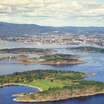 Nordre LangøyaThe northern part of the bathing island Langøyene in Bunnefjorden. Camping is allowed here. Norway's first cement factory was on Nordre Langøya from 1837 to 1938. 4.4
 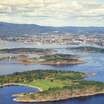 LangøyeneA popular bathing island in the Bunnefjord, formally part of Nesodden but owned and managed by Oslo. Originally two islands that grew together when the sound between them was filled with refuse: the city dump from 1904 to 1949, cleaned up between 2019 and 2021. Sand beach, camping and a naturist beach. 4.7
 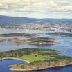 Søndre LangøyaThe southern part of the bathing island Langøyene in the Bunnefjord. Swimming and outdoor recreation, with a naturist beach at the southern end.
 Alværn
Nesodden 5 islandsThe seasonal ferry «Undine» out to the Steilene islets. It runs in summer only.
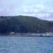 SteileneGroup of five islets in the inner Oslofjord off Nesodden: Persteila, Landsteila, Storsteila, Knerten and Fyrsteila. A state-secured public recreation area with buildings of heritage value from older industry, a coastal trail cabin (*kystledhytte*) in the old lighthouse, and a small-boat harbour, beach and fire pit on Persteila. The name is tied to an old execution site. 12.7 PersteilaThe main islet in the Steilene group off Nesodden, and the best equipped: small-boat harbour, beach, showers and a shared fire and barbecue site. A popular anchorage. 13.0
 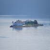 FyrsteilaFyrsteila is the lighthouse island in the Steilene group off Nesodden. The decommissioned lighthouse is run today as a coastal trail cabin (*kystledhytte*) by Oslofjordens Friluftsråd, and it hosts “Kunstfyret”, where children meet history, art and nature.
 Drøbak
Frogn 8 islandsAcross Drøbaksundet to Oscarsborg and Håøya. The fortress ferry runs all year, the Håøya boat in summer.
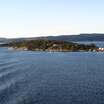 Søndre LangåraIsland at the northern end of Frogn, about 1.3 km long, with 61 cabin properties. The protected fog bell station on the northern tip can be rented through Kystled Oslofjorden. 21.6
 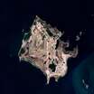 LågøyaIsland north of Håøya, about 900 metres long and 13 hectares (130 dekar), with 21 rental cabins, a tennis court and a boathouse. Owned since 2022 by the Sparebankstiftelsen DNB foundation and managed as a public recreation area by DNT Oslo og Omegn together with Oslofjordens Friluftsråd. 22.3
 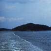 AspondIsland in the northern part of the Drøbak sound, about 30 hectares (300 dekar) with around 46 cabins. Privately held, with the main shipping lane in to Oslo passing close along the east side. The B21 boat calls at its own quay here; otherwise private boat. 23.8
 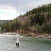 Nordre HåøyaThe northern part of Håøya, the large recreation island in the inner Oslofjord owned by the City of Oslo. Walking country and room for tents; harbours include Dragsundet. 26.6
 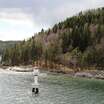 HåøyaThe largest island in the inner Oslofjord (5.2 km²), owned and managed by the City of Oslo as public outdoor land, with campsites and several harbours (Sagbukta, Tåjebukta, Dragsundet). Varden, 229 metres above sea level, is the highest point anywhere on the Oslofjord. Gunpowder was made on Mellomøya during the First World War. It is a popular destination for walkers and boaters. 26.8
 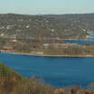 Nordre KaholmenThe northern of the two Kaholmene islets that make up Oscarsborg fortress in Drøbaksundet. The torpedo battery that sank the German cruiser Blücher on 9 April 1940 stood here. Part of the fortress area open to visitors. 27.2
 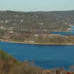 KaholmaneNordre and Søndre Kaholmen, the two islets that together are Oscarsborg fortress in the Drøbak sound. A national fortress with a museum, hotel, restaurant and opera festival, known for sinking the cruiser Blücher on 9 April 1940. 27.3
 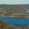 Søndre KaholmenThe main island of Oscarsborg fortress, with the main fort from 1848. Today it is a national fortress site with a museum, hotel and restaurant, and the stage for the Oscarsborg opera every August. Around 100,000 visitors a year.
 Horten
Vestfold 1 islandBastøy. The island is a working prison, so access is not open.
Tønsberg og Tenvik
Færder 5 islandsOut into Færder national park. Bolærne in summer, Veierland all year.
 Vestre BolærenThe westernmost of the main islands in the Bolærne group, in the outer Oslofjord off Nøtterøy. Military history from Bolærne fort, after the Norwegian Armed Forces bought the islands in 1916, and most of it is part of Færder National Park. Good for swimming and walking. 78.2
 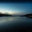 BolærneAn island group in the outer Oslofjord off Nøtterøy: the three main islands Vestre, Mellom and Østre Bolæren plus some 40 smaller islets and skerries, 2.6 km² in all. Settled since the 1600s, bought by the Norwegian Armed Forces in 1916 for the Bolærne coastal fort, and now a popular summer destination, with a seasonal ferry from Tønsberg. Most of it falls within Færder National Park. 78.3
 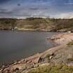 Mellom-BolærenThe middle island in the Bolærne group and the one best set up for visitors, with a seasonal ferry from Tønsberg. Grevestuen, one of Norway's oldest hunting lodges, is here, along with traces of military history. Most of it is part of Færder National Park, and it is popular for swimming and outdoor life. 79.2
 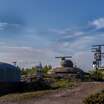 Østre BolærenØstre Bolæren is the easternmost of the main islands in the Bolærne group. It carries clear traces of Bolærne fort and the military installations from 1916. During the war the Germans had a camp for Soviet prisoners of war in the area. Most of it is inside Færder National Park. 87.7
 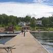 VeierlandA car-free island of 4.16 km² with around 150 permanent residents and many holiday homes. Ferries run from Tenvik on Nøtterøy and from Engø near Sandefjord. Edvard Munch spent the summer of 1887 here, and Jens Bjørneboe lived his last year in the Swiss-style villa Eikvold. The church dates from 1905.
 Skjærhalden
Hvaler 6 islandsThe far end of the fjord, more than a hundred kilometres from Rådhusbrygga. Scheduled boats to the car-free islands.
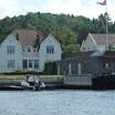 Nordre SandøyA car-free island in eastern Hvaler with a network of walking paths and a summer café at Makø farm. A mix of old family farms and modern cabins, after the fishing industry disappeared. 101.3
 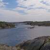 Nordre LauerPart of the Lauer islands, which historically held an important fish receiving station where catches from the surrounding fishing stations were landed. It is car-free and thinly populated today. 102.0
 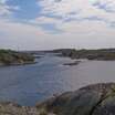 LauerLauer is an island group south of Kirkøy made up of Nordre Lauer, Sva Lauer, Mellomholmen and Sør-Lauer. Nordre Lauer is the main island, with around 34 holiday cabins and a small-boat harbour. It is a popular destination in the outer Hvaler. 102.0
 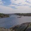 Søndre LauerPart of the Lauer islands, which historically held an important fish receiving station for the surrounding archipelago. Car-free and barely inhabited today. 103.4
 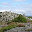 Søndre SandøySøndre Sandøy is a car-free island in the southeast of Hvaler, with sandy beaches, walking paths and dense conifer forest. Its distinctive gneiss was used as facing stone on Oslo City Hall. Prince Christian Frederik came ashore here in 1813, before he became king. There is a Bronze Age burial cairn at Sanderød and an old herring salting house at Gravningsund. 103.6
 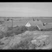 HerfølThe southernmost inhabited island on Hvaler, close to the Swedish border, with around 20 permanent residents. Once a fishing station with a customs post and a pilot station, it is now a summer destination with a marina, pub, shop and swimming spot. Protected Bronze Age burial cairns, among them Langrøsset, and the glacial pothole known as Katedralen.
 Hankøsundet
Fredrikstad 1 islandA short crossing to the sailing island, which has no road link.
Others
2Islands with a boat connection that does not belong to a fixed route.
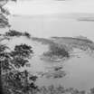 IldjernetA small island (0.17 km²) in the inner Oslofjord off Nesodden. From around 1895 to 1903 Elgjarnes Bad was here, a resort with sea bathing, a spa, a revue stage and a dance floor. Today there are no permanent residents, only cabin owners. 10.8
 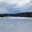 BorøyaA recreation island off Sandvika in the inner Oslofjord, with no permanent residents. There are public barbecue sites on the east and west sides, and camping is allowed for up to two nights.
 That leaves 56 islands with no service at all, listed under «Own boat». A boat is the only way to reach them. Oslo Sea Experience runs private fjord trips from Tjuvholmen between May and September, with up to seven aboard.
Times and seasons change. Ruter covers the inner fjord, Entur the rest.