Photo: Kurth Brekke·CC BY 3.0· Wikimedia Commons
Islands / Færder / Østre Bolæren
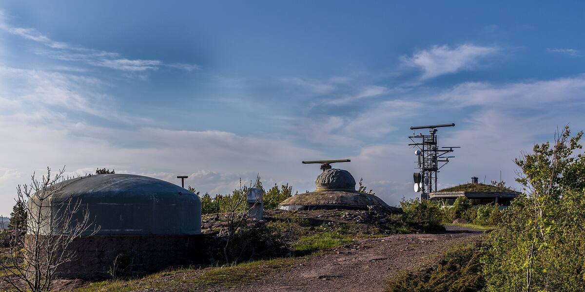
Østre Bolæren is the easternmost of the main islands in the Bolærne group. It carries clear traces of Bolærne fort and the military installations from 1916. During the war the Germans had a camp for Soviet prisoners of war in the area. Most of it is inside Færder National Park.
This is the easternmost of the three large Bolærne islands, 0.59 km², rising to 35 metres. Bolærne fort stood here. The ferry from Tønsberg berths at the guest harbour, where the old military installations are now an activity and conference centre. On the northwest side a compass rose is carved into the rock.
Færder National Park. The boundaries and the rules are in Naturbase, and they are worth checking before you land anywhere outside the marked areas.
Part of Kystled Oslofjorden. See all the coastal trail cabins.
Ferry from Tønsberg / private boat.
Boats do run here, but the quay is not in Entur’s system. It is usually a summer service or a private crossing that never enters the national journey planner. Check with the operator before you build a day around it.
The armed forces bought Bolærne in 1916 to build a coastal fort at the outer end of the Oslofjord. Bolærne fort on Østre Bolæren was operational from 1916 to 1999 and formed part of the barrier across the approach together with Rauøy fort. Artillery and minefields were meant to close the fjord.
During the Second World War the installation became part of Festung Norwegen and was expanded by the Germans, using Soviet prisoners of war as labour. The prison camp was on Mellom-Bolæren, immediately west.
The compass rose in the northwest rock face has 16 lines and measures 24 to 25 centimetres across. Analysis of the magnetic declination suggests it dates from the middle of the 1500s. Vestfold county bought the island in 2004 and converted the military installations into an activity centre.
The island is run as an accommodation and conference venue with room for 236 people, a restaurant, meeting rooms and a guest harbour for 75 boats. Canoes, kayaks and rowing boats are for hire, and there are volleyball and football pitches. A protected coastal spruce forest grows here. It became part of Færder National Park in 2013. Vestfold county owns 90 per cent and Færder municipality 10 per cent.
A regular ferry connects Tønsberg with Østre Bolæren. Check the operator's current timetable, since departures vary with the season. The guest harbour takes up to 75 boats. Accommodation and meals are booked through the operating company on the island. Protection: Østre Bolæren is inside Færder National Park, established in 2013. The coastal spruce forest is protected, so keep to the paths and the signed areas. Check Naturbase, the national database of protected areas, for any access restrictions on the neighbouring islets.
The compass rose in the rock was cut some time in the 1500s. Sailors used it to check their compasses against a fixed reference on land, long before the fort arrived.
A coastal fort that was in service for 83 years, from 1916 to 1999, is now a place people book for Christmas parties and weddings. The gun positions and bunkers are still there between the football pitch and the restaurant.
The fort flanked the fjord together with Rauøy on the other side. Between them the two forts could close the whole approach to Oslo with fire and mines.
Oslo Sea Experience passes Østre Bolæren on its private fjord trips from Tjuvholmen.
The Norwegian version notes which facts were taken from each source: Østre Bolæren på norsk.