Photo: Tore Sætre·CC BY-SA 4.0· Wikimedia Commons
Islands / Oslo / Rambergøya
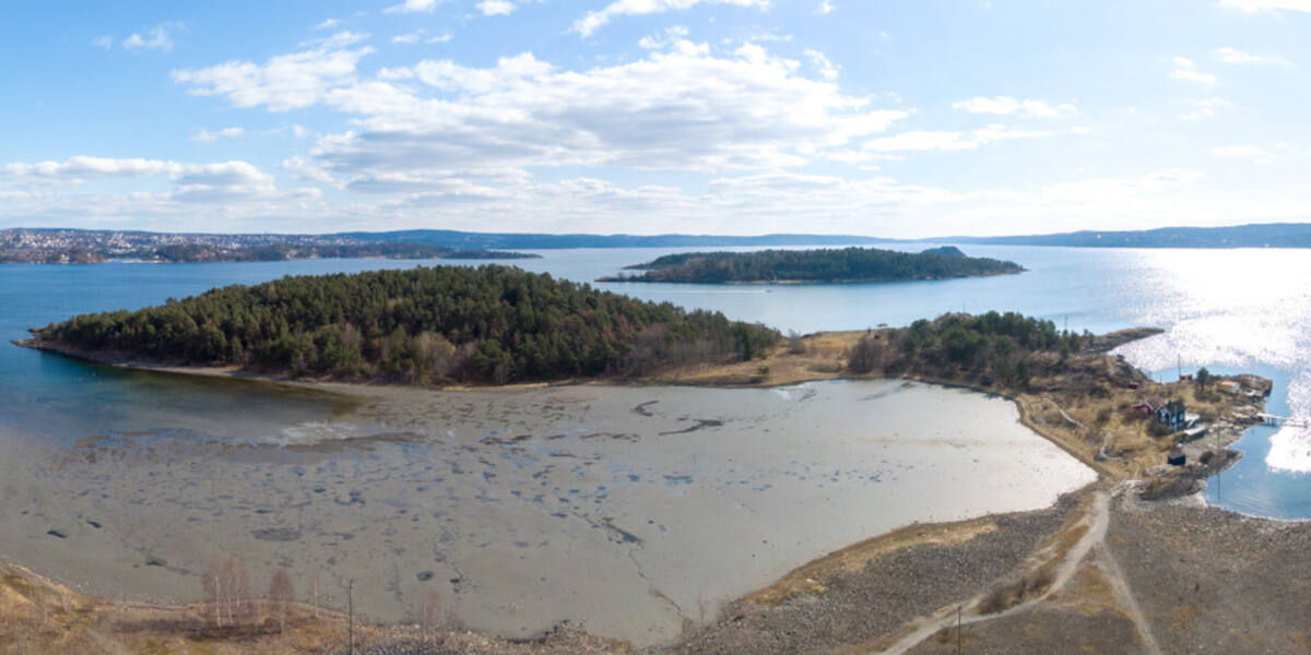
Island of about 12 hectares (120 dekar), joined by land to Gressholmen and Heggholmen and part of the Gressholmen-Rambergøya nature reserve. The lime-rich pine forest (*kalkfuruskog*) here is among the most intact on the islands of the inner Oslofjord. There are swimming spots.
Rambergøya is the southernmost of the three connected islands southeast of Bygdøy. Gressholmen, Rambergøya and Heggholmen hang together as one landmass on stone causeways. The low pine-covered ridge on the south side carries one of the best-preserved lime-rich pine forests on the islands of the inner Oslofjord. The shallow bay towards Gressholmen is strictly protected, so keep well off the shore there in spring and early summer.
Gressholmen-Rambergøya nature reserve; in the shallow bay towards Gressholmen, motorised traffic is prohibited all year, and all traffic by boat or board is prohibited from 1 April to 15 July. The boundaries and the rules are in Naturbase, and they are worth checking before you land anywhere outside the marked areas.
Private boat or kayak, or on foot via Gressholmen (ferry from Rådhusbrygge 4).
Boats do run here, but the quay is not in Entur’s system. It is usually a summer service or a private crossing that never enters the national journey planner. Check with the operator before you build a day around it.
Rambergøya covers around 12 hectares (120 dekar) and lies out in the fjord between Bygdøy and Nesodden. The island has never had settlement of any consequence; its history is about the natural ground and about how it came to be tied to its neighbours. Stone causeways join Gressholmen, Rambergøya and Heggholmen, so you can walk between them dry-shod.
Protection came in 1992, when the Gressholmen-Rambergøya nature reserve was established. At its core are the lime-rich pine forest and the shallow shoreline meadows, which are among the most intact in the inner Oslofjord. In 2012 a moss called *tanntustemose* was found on the island, a species that had not been recorded in Norway for 120 years and is listed as endangered (EN) on the national Red List.
Rambergøya is part of the heavily used recreation area in the Gressholmen group. It has swimming spots and walking paths through pine forest and shoreline meadow. Because it is joined to Gressholmen, most visitors arrive on foot from the café and the quays there. Parts of the vegetation in the reserve are vulnerable, so traffic is channelled onto the paths.
Private boat or kayak, or on foot via Gressholmen, which has a ferry from Rådhusbrygge 4, the City Hall quay. In the shallow bay between Gressholmen and Rambergøya, motorised traffic is prohibited all year. From 1 April to 15 July the ban widens: all traffic by boat, rowing boat and sailboard is prohibited in the bay, to protect birds and shoreline vegetation. Check Naturbase, the national database of protected areas, for the rules in force before going ashore anywhere other than the prepared sites.
The pine forest here grows on lime-rich ground, which gives it a flora you do not find everywhere. The lime-rich pine forest on Rambergøya counts as one of the best preserved on the whole island chain in the inner fjord.
In 2012 a moss turned up here, *tanntustemose*, that no one had recorded in Norway for 120 years. A small island in the middle of Oslo's swimming grounds was holding on to a species botanists thought was gone.
Oslo Sea Experience passes Rambergøya on its private fjord trips from Tjuvholmen.
The Norwegian version notes which facts were taken from each source: Rambergøya på norsk.