OSLO FJORD ISLANDS A REFERENCE WORK
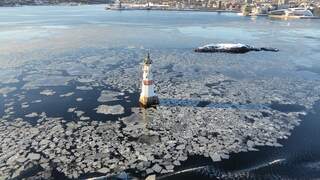
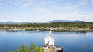
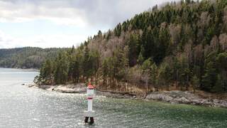
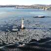
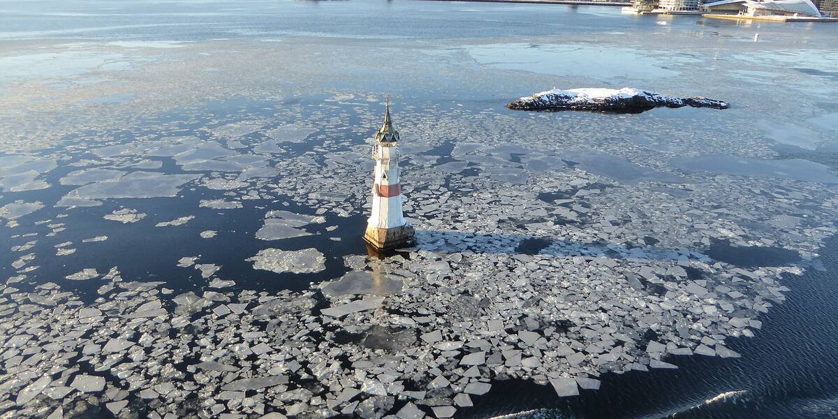
The Kavringen light ringed by drift ice in the Oslo fjord, seen from above

The Oslo fjord · $<Tall n={1230} lang={lang} /> named islands, islets and skerries

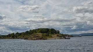
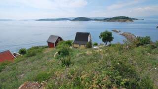
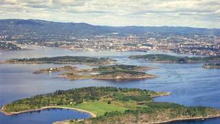
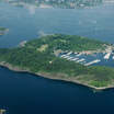
The islands of the Oslo fjord

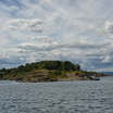
Kavringen, 1.3 km from Rådhusbrygga · Photo: Leif Jørgensen · CC BY-SA 4.0

Hovedøya sits less than 500 metres off the quay. On the way out the boat passes Kavringen, a skerry with barely room for its own lighthouse. Inside that lighthouse stands a titanium canister that is not to be opened until the year 3000.

There is a lot of that out here. Norway’s first airport was built on a grazing island and worked only in summer; when the fjord froze, civil aviation stopped. Bleikøya held a sanatorium where children with tubercular glands were sent for the sea air, and the writer Oskar Braaten was one of them. The grass people barbecue on at Langøyene covers forty years of Oslo’s household waste.

The Norwegian Mapping Authority has recorded 1,230 named islands, islets and skerries in this fjord. Very few of them appear in any guidebook. Here are 125, with what actually happened on them, how to get there, and what the rules are once you arrive.
Weekend planner Which island can I reach this weekend, without my own boat, where a cabin is still free? 17 of the 18 islands with a cabin, it turns out. Four cabins keep a rowing boat for you at a mainland quay, four have a named water taxi, and fourteen are reached on foot or by bus. 43 cabins 17 islands, no boat of your own live availability

Things people sail past

Nine findings from the sources

Since 2000 the Kavringen light has held Oslo's time capsule, a titanium container due to be opened in the year 3000. A lighthouse on a bird reserve is the city's letterbox to people a thousand years ahead.

Kavringen1.3 km from the city

Norway's first airport lay out here on a grazing island, and it could only be used in summer. When the fjord froze, the flying stopped, which is why Sola and later Fornebu took over.

Gressholmen3.0 km from the city

Before the cabin owners came, this was an island for sick children. The sanatorium ran from 1885 to 1926, treating glandular tuberculosis with fresh sea air.

Bleikøya2.4 km from the city

The grass people picnic on sits on top of more than 45 years of Oslo's household waste. The sand was trucked in; the ground beneath it is the city's own history in compressed layers.

Langøyene4.4 km from the city

The pine forest here grows on lime-rich ground, which gives it a flora you do not find everywhere. The calcareous pine forest on Rambergøya counts as one of the best preserved on the whole island chain in the inner fjord.

Rambergøya3.5 km from the city

The cabin town began as tents around 1905. A midsummer party with dancing around 1920 triggered the first restrictions, and eventually the arrangement that produced the 289 cabins.

Lindøya2.5 km from the city

Long before the cabins, an optical telegraph stood here, built in 1809 to pass word on about enemy ships heading for Akershus during the Napoleonic Wars.

Nakkholmen3.2 km from the city

The rock here is an open book of geology. Trilobites, corals and graptolites sit in the smooth bedrock from a time more than 400 million years ago, when the area lay under a shallow tropical sea south of the equator.

Malmøya5.0 km from the city

Ulvøen Rundt is an open-water race around the island, revived in 2014 with 54 swimmers. The distance is 2,250 metres, and the fastest came round in 33 minutes.

Ulvøya5.1 km from the city

Articles

Newest first

All the articles are under Articles.

Closest to the city

From Rådhusbrygga, as the crow flies

1.3 KavringenA small, whale-backed skerry northwest of Hovedøya carrying the Kavringen light. Together with the shallows around it, it makes up a seabird reserve established on 15 December 1978 to protect seabird nesting sites. Oslo Own boat 1.9 HovedøyaOslo's best-known recreation island (0.47 km²), and the one carrying the most history: the ruins of a Cistercian monastery founded in 1147, medieval quarries, fortifications from 1808 with their cannon and powder magazines, and German army barracks from the Second World War. Rich plant life, notable geology, and popular places to swim. Oslo Ferryroute 2.4 BleikøyaA small island in the inner Oslofjord between Hovedøya and Sjursøya, with around 90 holiday cabins from the 1920s and 30s. From 1885 to 1926 it held a sanatorium for children with scrofula, a form of tuberculosis; the writer Oskar Braaten was a patient here as a boy. State-owned and managed by Statsbygg, the government property agency. Oslo Ferryroute 2.5 LindøyaA state-owned island (0.41 km²) in the inner fjord, known for its 289 small cabins organised into 16 sections. The settlement began with tents around 1905. There is a shop, a football pitch and swimming spots open to the public. Oslo Ferryroute 2.6 HerbernGroup of islets southeast of Bygdøy in the inner Oslofjord, made up of Store Herbern and Lille Herbern. Store Herbern is a nature reserve with shore vegetation and several rare species; Lille Herbern is known for its summer restaurant. Oslo Seasonal boat 2.6 Lille HerbernA small islet right next to Store Herbern, southeast of Bygdøy. Known for a long-established summer restaurant reached by a small ferry from Bygdøy. Oslo Seasonal boat 2.8 Store HerbernA small islet of about 1.3 hectares (13 dekar) southeast of Bygdøy, under 5 metres high and separated from Bygdøy by a very shallow sound. The whole islet is a nature reserve, established to preserve untouched ground with varied shore vegetation and several rare species. Oslo Own boat 3.0 GressholmenOne of the most visited islands in the inner Oslofjord, joined by land to Rambergøya and Heggholmen. Norway's first airport opened here in 1927 and served as the country's main airport until 1939. Gressholmen Kro, the island inn, runs through the summer. Several bathing spots, including a naturist area. Oslo Ferryroute

See all 125 islands with search and filters, or the register of 1,105 islets and skerries.