Photo: 1560Pal·CC BY-SA 4.0· Wikimedia Commons
Islands / Moss / Eldøya
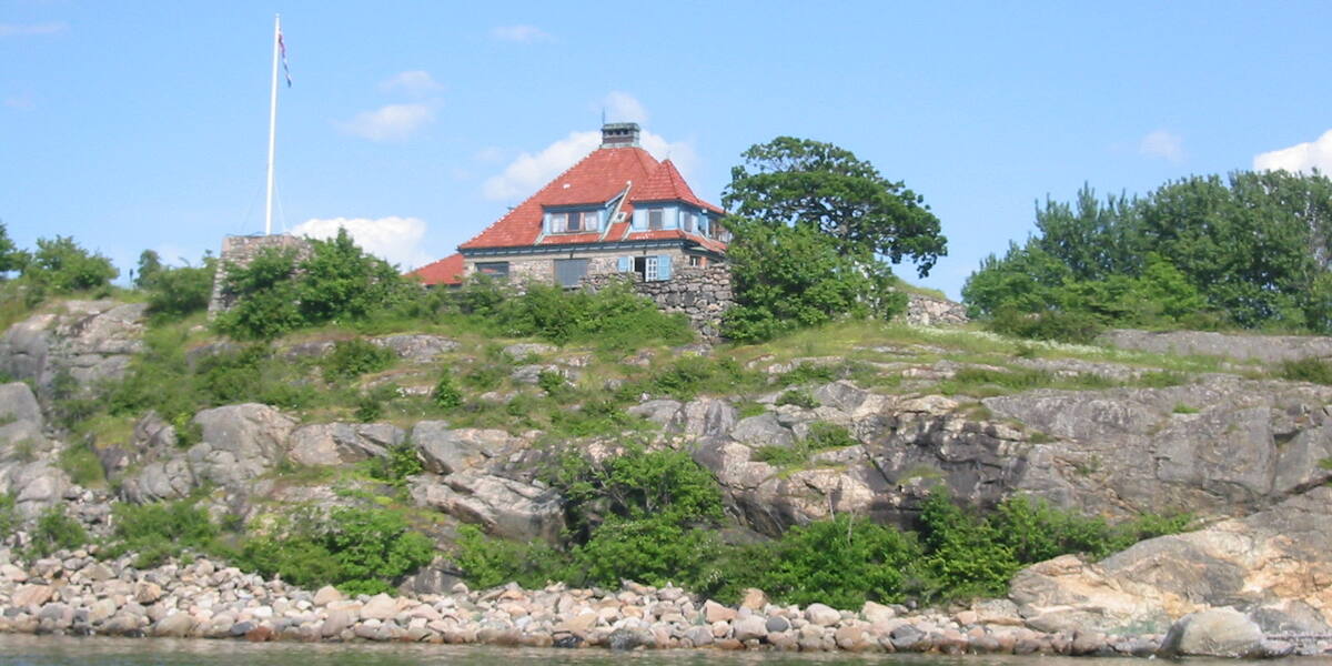
An island west of Larkollen that forms a sheltered harbour together with the islet Kollen. It was inhabited for centuries and was once the summer harbour of Værne monastery (Værne kloster). The rock is red sandstone and conglomerate. There are Bronze Age remains and a cairn. Sandtangen in the northeast is a small swimming spot for smaller boats.
Eldøya lies west of Larkollen, and the sound between it and the neighbouring islet Kollen is the old harbour, where boats have taken shelter for centuries. The rock is unmistakable: reddish sandstone and conglomerate, quite unlike the grey granite skerries elsewhere in the fjord.
Eldøya-Sletter landscape protection area (1997); nature reserve in the northwest, closed during the seabird nesting season (check Naturbase). The boundaries and the rules are in Naturbase, and they are worth checking before you land anywhere outside the marked areas.
private boat or kayak; Sandtangen (northeast) for smaller boats.
No scheduled boat comes here. You will have to find the nearest public quay yourself, and the rest is your own boat or a kayak. Check the wind and wave forecast before you set out. The open stretches in the outer fjord turn unpleasant in a fresh breeze.
The bedrock on Eldøya is red sandstone and conglomerate of volcanic origin, part of the same Permian Oslo Rift (*Oslofeltet*) that builds up Jeløya and Revlingen. The high point is 22 metres above sea level, in the southwest. A collapsed Bronze Age burial cairn sits on the top, with a seamark cairn for shipping next to it.
Værne monastery used Eldøya as a summer harbour for its livestock far back in time. The island was inhabited for long stretches. The tax assessment in 1643 was one barrel of cod. In 1711 there were two houses with two or three cows, and the people here made their living from fishing and selling beer. Six families lived on Eldøya in 1801. Then it went downhill, and by 1875 only one family was left. In 1905 Eldøya was separated from Værne kloster and bought by Valentin August Sibbern (1843–1918).
Nobody lives on Eldøya, and the whole island is inside a landscape protection area. It is a destination for people with their own boat, or with a kayak from the Larkollen side.
No scheduled boat calls at Eldøya, so you need your own boat or a kayak. Smaller boats can go in to Sandtangen in the northeast. The whole area is protected: Eldøya-Sletter landscape protection area (*landskapsvernområde*) was established in 1997 to preserve the natural and farmed landscape. The northwestern part of the island is a nature reserve of its own, closed during the seabird nesting season. Most such reserves in the Oslofjord are closed from 15 April to 15 July, but the exact dates for Eldøya nature reserve are in its own protection regulation. Read it on Naturbase, the national database of protected areas, before you land. The dates are set in law for each reserve.
The monks at Værne sent their cows out here for summer grazing, a monastery economy that used the archipelago as pasture. Eldøya stayed monastery property until 1905, when it was separated off and sold.
Most skerries in the fjord are grey granite. Eldøya is Permian sandstone and conglomerate, from the same volcanic episode that shaped Jeløya, and the warm red shows clearly from the water.
The burial cairn on the summit is from the Bronze Age, and a seamark cairn stands right beside it. The same high point was used to bury the dead and to show the living the way at sea, thousands of years apart.
Oslo Sea Experience passes Eldøya on its private fjord trips from Tjuvholmen.
The Norwegian version notes which facts were taken from each source: Eldøya på norsk.