Photo: Unknown authorUnknown author·Public domain· Wikimedia Commons
Islands / Hvaler / Torbjørnskjær
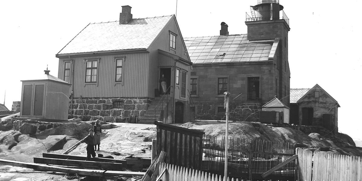
A storm-beaten skerry at the mouth of the Oslofjord with Torbjørnskjær lighthouse from 1872, protected under the Cultural Heritage Act. The light was automated and the keepers withdrawn in 1990, and the buildings stand empty.
Torbjørnskjær is a low, storm-beaten skerry right at the mouth of the Oslofjord, southwest of the Hvaler islands. What you see is the lighthouse: a stone tower raised on bare rock with open sea on every side. Keep your distance. The skerry takes the sea hard.
Protected lighthouse station (Cultural Heritage Act). The boundaries and the rules are in Naturbase, and they are worth checking before you land anywhere outside the marked areas.
No landing; the landing stages are closed because of decay.
No scheduled boat comes here. You will have to find the nearest public quay yourself, and the rest is your own boat or a kayak. Check the wind and wave forecast before you set out. The open stretches in the outer fjord turn unpleasant in a fresh breeze.
Torbjørnskjær was lit as a coastal lighthouse in 1872. The station got a stone dwelling of 13 × 10.5 metres with an attached stone tower of 4 × 4 metres, topped by an octagonal lantern house with a third-order lens. The tower is 17.9 metres high, and the light is 25.7 metres above high water with a range of 10.4 nautical miles.
It was run as a family station until 1949, with the keeper and his household living out on the rock. The fog signal followed the technology of the day: a bell, then a fog horn from 1895, and a tyfon from 1956.
In 1904 Torbjørnskjær was almost on the epicentre of the strongest earthquake in southern Norway in modern times, measured at 5.4 on the Richter scale.
The station was automated and the keepers withdrawn in 1990, and it was protected under the Cultural Heritage Act in 1997. No new use has been found for it.
The light still works automatically (Fl W 10s). The buildings are empty and the landing stages are closed because of decay. Torbjørnskjær is a protected monument to be seen from the water, and going ashore is not possible.
There is no landing here. The stages have decayed and are shut, and the skerry is exposed and storm-beaten, so keep well off, particularly in a swell or poor visibility. The lighthouse has been protected under the Cultural Heritage Act since 1997, and the buildings are not to be touched.
It was a family station until 1949: people lived out there with their children on a rock the sea washes over in a storm.
In 1904 the strongest known earthquake in southern Norway in modern times (5.4) had its epicentre almost on top of the lighthouse.
The station is automated and protected at once: the light works, the house decays, and no one may land.
Oslo Sea Experience passes Torbjørnskjær on its private fjord trips from Tjuvholmen.
The Norwegian version notes which facts were taken from each source: Torbjørnskjær på norsk.