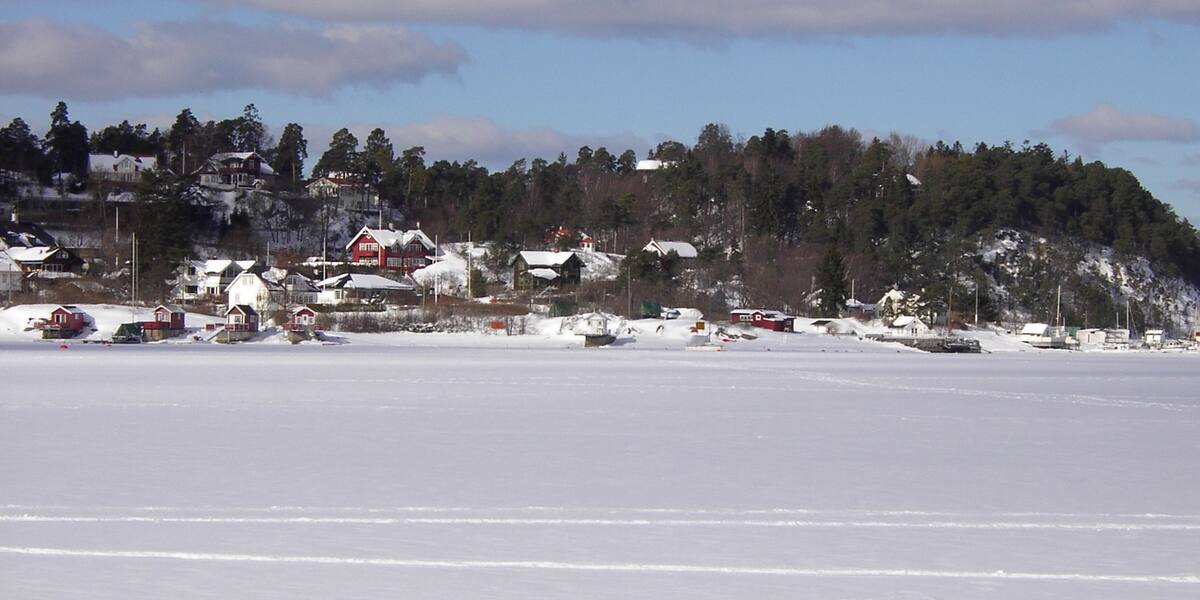
Photo: EspenAndersen·CC BY-SA 4.0· Wikimedia Commons
Islands / Oslo / Malmøya
A residential island in southeast Oslo with around 180 households, given to Mariakirken in 1307 and church property until the Reformation. Skinnerbukta on the west side is a favourite anchorage with a public swimming spot. Known for its geology and its Cambro-Silurian fossils: trilobites, corals and graptolites.
Malmøya is in the southeast of Oslo, in the Bunnefjord, a residential island of around 60 hectares (600 dekar) joined to the mainland by bridge. From the water on the west side you see Skinnerbukta, a calm west-facing bay and one of the most used anchorages in the inner fjord. The smooth rock around the bay is full of fossils from a time when the whole area was tropical seabed.
Malmøya og Malmøykalven nature reserve (four areas merged in 2008; originally protected in 1979). The boundaries and the rules are in Naturbase, and they are worth checking before you land anywhere outside the marked areas.
Road access over the 1966 bridge across Malmøysundet (via Ormøya); bus 85 from Jernbanetorget.
The island is connected by road, so you need neither a boat nor a timetable.
Malmøya was given to Mariakirken, St. Mary's church in Oslo, in 1307, and stayed church property until the Reformation. In the early 1800s the island was divided into plots for well-off Oslo families. There were 62 properties in 1888. Just before the Second World War the number had grown to 141. Today there are around 180 households.
A fixed road connection came in 1966, with a bridge over Malmøysundet to Ormøya and on to the mainland. Before that, boats were the only way across. The roads are private and narrow, and parking is mostly prohibited.
Among specialists, geology is what Malmøya is known for. The bedrock is sedimentary rock from the Cambro-Silurian, packed with fossils of trilobites, corals and graptolites, along with volcanic rock from the Permian. Malmøya is a reference locality for Norwegian geology.
Malmøya has around 180 households and a permanent population. Solvik on the west side has a swimming spot and a café, with access arranged for visitors with reduced mobility. There are two small-boat harbours, rowing and sailing clubs, and Skinnerbukta as a popular anchorage.
Malmøya is reached by car over the 1966 bridge, via Ormøya, or by bus 85 from Jernbanetorget by Oslo Central Station. By boat, Skinnerbukta on the west side is the usual anchorage, with a public swimming spot at Solvik. Malmøya og Malmøykalven nature reserve consists of four areas that were merged in 2008, having first been protected in 1979. The reserves cover geology, pine forest and bird life. The fossils in the rock are protected. Nothing may be chipped out or carried off. Check Naturbase, the national database of protected areas, for the current boundaries.
The rock here is an open book of geology. Trilobites, corals and graptolites show in the smooth bedrock. They are more than 400 million years old, from a time when the area lay under a shallow tropical sea south of the equator.
The island belonged to the church before it belonged to anyone else, given to Mariakirken in 1307 and church property for more than two hundred years.
Until 1966 Malmøya depended on boats. The bridge over Malmøysundet turned it into a suburb you can drive to.
Oslo Sea Experience passes Malmøya on its private fjord trips from Tjuvholmen.
The Norwegian version notes which facts were taken from each source: Malmøya på norsk.