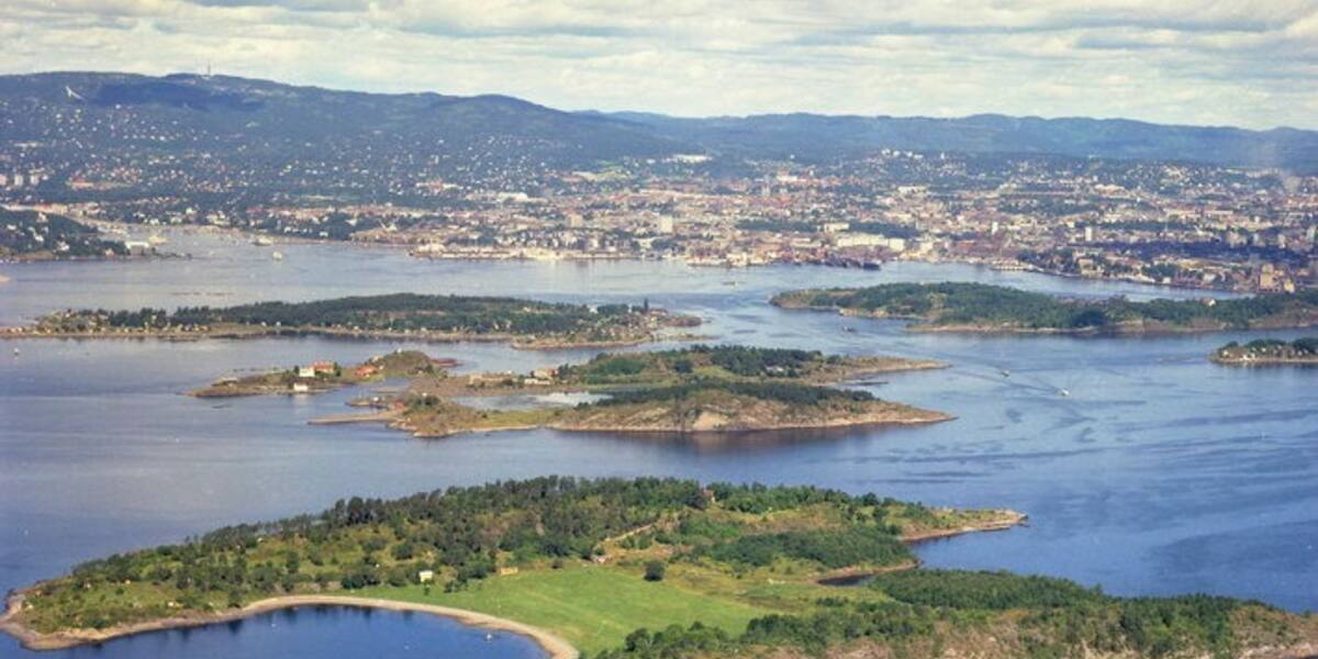
Photo: Halvor Pritzlaff Njerve, Oslo kommune / Bymiljøetaten·Fri bruksrett· Oslo kommunes mediebank
Islands / Nesodden / Langøyene
A popular bathing island in the Bunnefjord, formally part of Nesodden but owned and managed by Oslo. Originally two islands that grew together when the sound between them was filled with refuse: the city dump from 1904 to 1949, cleaned up between 2019 and 2021. Sand beach, camping and a naturist beach.
Low and drawn out in the southern Bunnefjord, between the Nesodden shore and Bekkelagsstranda, this is Oslo's popular bathing island. It looks like one island now, but it is really two, Nordre and Søndre Langøya, grown together in the middle. The flat grassy waist lies directly over the old city dump.
Ferry from Aker Brygge in summer.
Times shift with the season, and several of the island boats run only in summer. Check the current timetable at Ruter.
Langøyene covers 0.3 km² and belongs to Nesodden municipality, but Oslo owns and manages it. Industry came early: Norway's first cement factory operated on Nordre Langøya from 1837 to 1938, using limestone brought over from Malmøya.
The refuse history is what shapes the island today. In 1899 Kristiania, as Oslo was then called, turned down Nakholmen as a dump site, and in 1900 Langøyene emerged as the alternative. The purchase went through in 1902 over protests from Nesodden. From 1904 to 1949 the city tipped its waste here. From 1908, when Aker stopped dumping on its own ground, the sound between the two islands became the main receiving point, and most of it ended up there. In 1910 wrecks were sunk at both ends of the sound to hold the refuse in place. In 1922 large cranes arrived that could lift three tonnes at a time. The waste came on flat-bottomed barges with hatches in the bottom, loaded with up to 70 tonnes, and about thirty men spread it with wheelbarrows and spades. The decision to close came in 1938, but German occupation forces restarted the operation after the last ordinary load on 8 April 1940. The final load arrived in 1949.
In 1952 Langøyene opened as a beach, with sand trucked in on top of the fill. That held until 2013, when old waste worked its way to the surface and samples showed elevated levels of lead and mercury. Oslo city council granted 304 million kroner for a clean-up, carried out from autumn 2019 to spring 2021. The old landfill was capped with 360,000 tonnes of material, and the north side was given erosion protection.
Langøyene is the most used bathing island in Oslo through the summer. Tent camping is allowed on the northern part, and the southern part has a naturist beach. It has a sand beach, smooth rock slabs and wide open grass, and it fills up as soon as the weather turns warm.
A seasonal ferry runs from Aker Brygge in summer. Outside the season you need your own boat. There are moorings. Nothing operates here year round. No access restrictions are registered for the swimming spot itself, but respect the signage around the naturist beach and any newly planted ground left over from the clean-up.
The grass people picnic on covers more than 45 years of Oslo's household waste. The sand was trucked in. The ground beneath it is the city's own history in compressed layers.
When the waste surfaced again in 2013, the city's favourite bathing island turned into an environmental project costing more than 300 million kroner.
The sound that divided the two islands is gone. It was filled with refuse until they had become one.
Nesodden protested against the sale in 1902. The island is still formally theirs, but Oslo owns the ground and makes the decisions.
Oslo Sea Experience passes Langøyene on its private fjord trips from Tjuvholmen.
The Norwegian version notes which facts were taken from each source: Langøyene på norsk.