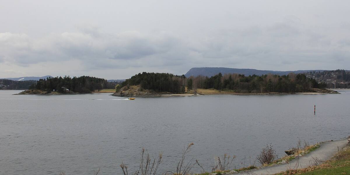
Photo: Chell Hill·CC BY-SA 3.0· Wikimedia Commons
Islands / Bærum / Kalvøya
Bærum's main swimming and recreation island in the inner Oslofjord, about 0.26 km², reached on foot over a footbridge from Kadettangen at Sandvika. It has beaches, walking paths and football pitches, plus a nature reserve of fossil-bearing Cambro-Silurian rock and protected Bronze and Iron Age burial cairns. The municipality bought it in 1939, and the bridge came in 1963.
Just west of Sandvika, with Kadettangen and the town centre behind you, lies a low green island with beaches along the south side and woodland on the north. The footbridge to the mainland is visible from the water, and on a fine summer weekend there is a steady stream of people crossing it. The football pitches and the swimming spots are all on the south side.
Nature reserve (geology and fossils) plus protected burial mounds on parts of the island. The boundaries and the rules are in Naturbase, and they are worth checking before you land anywhere outside the marked areas.
Footbridge from Kadettangen (connected to the mainland, open access).
The island is connected by road, so you need neither a boat nor a timetable.
The name says what the place was used for. In the 1500s the farm Nesøygården put its calves out here for summer pasture. In the middle are protected burial cairns from the Bronze and Iron Ages, so people were here long before the livestock.
Through the 1800s Kalvøya belonged to the Kjørbo estate. A map from 1825 shows a crofter's holding (*husmannsplass*) under Kjørbo on the west side. In 1912 the forestry graduate Eskild Bruun, who owned Kjørbo, offered free land to the rowers of Bærum. Bærum Roklubb was founded in 1917 and built a clubhouse on the northeast shore. In 1925 the club moved the building across to Kadettangen on the mainland, because there was no road connection. Frydenlunds Bryggeri paid for the whole move on condition that the club served only its drinks at events.
Bærum municipality bought Kalvøya in 1939 to secure it as public open space. The footbridge from Kadettangen followed in 1963 and put it within walking distance for anyone heading out for a swim.
From 1971 to 1997 Kalvøyafestivalen was held here, one of Norway's big music festivals. Sten Randers Fredriksen started it, and Paul Karlsen took over as festival director in 1977. Frank Zappa had his Norwegian breakthrough here in 1973 in front of around 20,000 people. Bob Dylan, Iggy Pop, Peter Gabriel, Eric Clapton and U2 played later, Nirvana in 1992, Pearl Jam in 1993 and David Bowie in 1997. Neil Young drew 30,000 in 1993. The festival ended after 1997, when the organisers could not book big enough names for the summer of 1998. Øyafestivalen used the site in 1999 before it moved into the city. Extrema Outdoor ran events on the island in 2010 and 2011, and stopped after 2011, when more than 180 people were caught with drugs at a single event.
Kalvøya is where Bærum goes to swim and spend the day. There are beaches, walking paths and football pitches, and on a sunny summer weekend some 20,000 people can be here at once. The east side has a naturist area. Children's culture festivals and youth tournaments use it through the season.
The north side is a nature reserve. The rock is Cambro-Silurian and fossil-bearing, part of the Oslo Rift (*Oslofeltet*). Along the south side, seabed deposits from the same period stand tilted almost 90 degrees, alternating between shale and limestone. Both the geology and the burial cairns are protected.
A footbridge from Kadettangen at Sandvika connects Kalvøya to the mainland, open on foot all year. Private boats can moor along the south side. The nature reserve on the north side protects the geology and the fossils: walking there is allowed, but felling, digging and removing rock or fossils are not. The burial cairns in the middle are automatically protected heritage sites, so keep your distance and leave them alone. Check Naturbase, the national database of protected areas, for the current reserve boundaries before going ashore anywhere other than the beaches.
Kalvøya means calf island. Calves were rowed out here for the summer so they would not get into the fields at home.
The rowing club that built a house here in 1917 gave up island life because there was no bridge. When they moved the building to the mainland in 1925, a brewery paid the entire bill in return for exclusive rights to the beer sales.
On a good summer day there are more people on this small island than in many Norwegian towns: 20,000 swimmers on 0.26 square kilometres.
The fossils in the rock on the north side are the remains of a seabed from a time when Oslo lay under a tropical sea, south of the equator.
Oslo Sea Experience passes Kalvøya on its private fjord trips from Tjuvholmen.
The Norwegian version notes which facts were taken from each source: Kalvøya på norsk.