Photo: Wolfmann·CC BY-SA 4.0· Wikimedia Commons
Islands / Færder / Nøtterøy
The municipality's main island, 44 km² with around 20,000 inhabitants, joined to Tønsberg by Kanalbrua. Rich prehistory and a medieval history that turns up in the sagas, with many swimming spots and a way into the whole archipelago. The highest point is Vetan, 99 m above sea level.
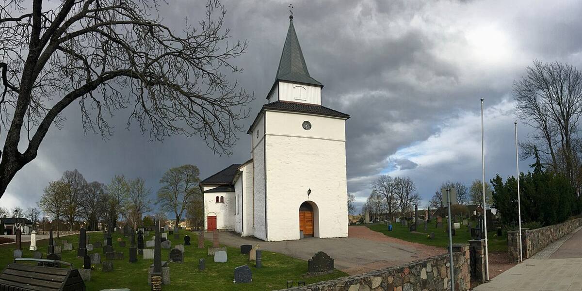
Nøtterøy is the large main island of Færder, 44 km² and around 20,000 inhabitants, and the link between Tønsberg and the archipelago running south. Coming from the north you pass under Kanalbrua from Tønsberg. From there the island stretches south towards Vrengenbrua and Tjøme. Inland there is farmland and a white medieval church rather than open skerries.
Road and bridge from Tønsberg (Kanalbrua).
The island is connected by road, so you need neither a boat nor a timetable.
Nøtterøy has a long prehistory and is mentioned in the sagas. Nøtterøy church at Borgheim dates from the 1100s and is among the oldest buildings in the district. Medieval sources name places on the island. In 1188 they describe the "Ramberghøsten", fighting at sea tied to the civil war years. In 1225 King Håkon Håkonsson's fleet crossed the ice at Skjeljastein on its way to Bergen.
For centuries the island was a farming and seafaring community. Nøtterøy was a municipality in its own right until 1 January 2018, when it merged with Tjøme to form Færder. During the occupation from 1940 to 1945 there were German fortifications at Håøya and Bolærne within the municipality, and Bolærne fort was demilitarised in 2005/2006.
The highest point is Vetan, 99.7 m above sea level, with a view over much of the archipelago.
Nøtterøy is densely populated, a suburb of Tønsberg. It still has swimming spots along the whole coast, and it is where people set out from when they head into the archipelago. Foynland in the northeast has a bridge of its own. The medieval church is still in use. From the quays and small-boat harbours on the south and east sides, the traffic carries on out towards Bolærne, Veierland and Tjøme.
Nøtterøy is reached by car over Kanalbrua from Tønsberg in the north, Vrengenbrua to Tjøme in the south, and Foynlandsbrua in the northeast. No ferry is needed for the island itself. Guest harbours and berths are available in several places along the coast. Nøtterøy has no area protection of its own. The outer parts of the municipality's archipelago fall within Færder National Park, and some of the islets offshore are seabird reserves with access banned from 15 April to 15 July.
Nøtterøy church has stood since the 1100s. It is older than most towns in the country.
In 1225 King Håkon Håkonsson took his fleet across the ice at Skjeljastein on Nøtterøy on the way to Bergen.
Vetan is 99.7 m, just short of a round hundred, and from up there you see much of the archipelago.
Oslo Sea Experience passes Nøtterøy on its private fjord trips from Tjuvholmen.
The Norwegian version notes which facts were taken from each source: Nøtterøy på norsk.